
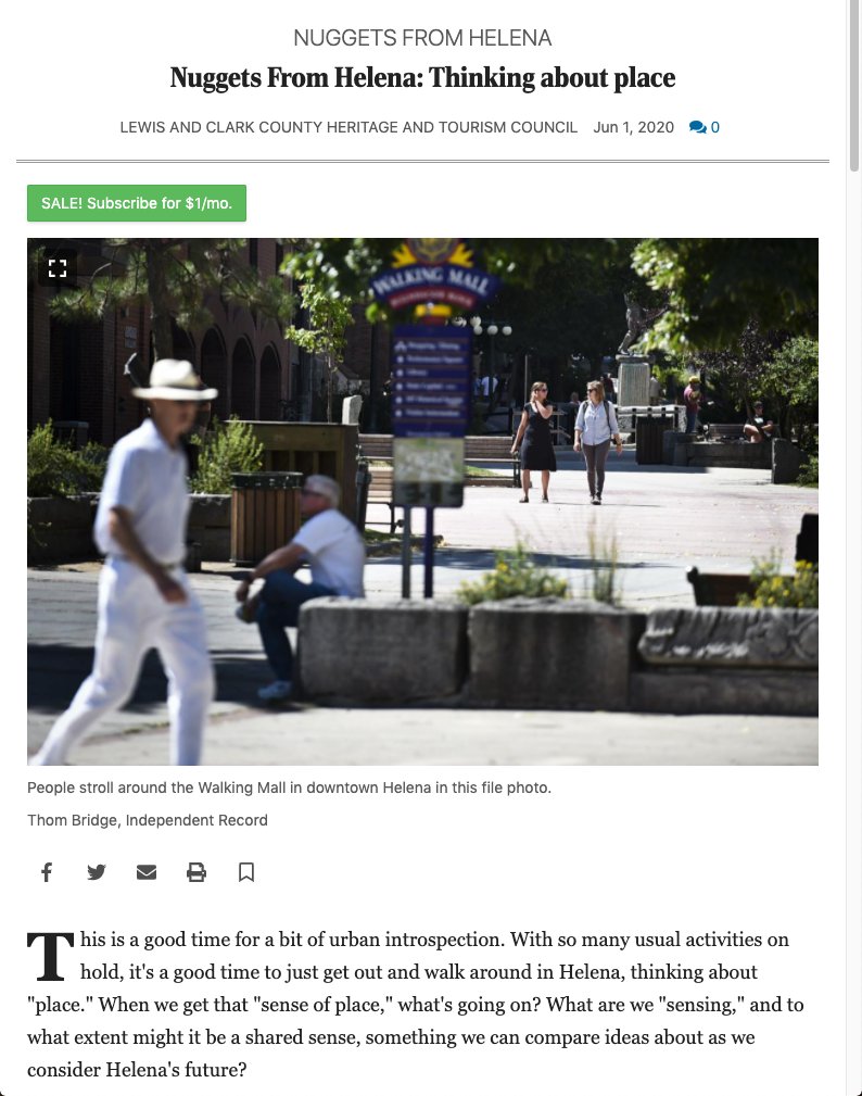
When we get that “sense of place”, what’s going on? What are we “sensing”, and to what extent might it be a shared sense, something we can compare ideas about as we consider Helena’s future?
This is an experiment. Consider this your invitation to take part. Walk routes you like, and think about why you like them. What draws you on? Take notes. If enough curious folks do this, we can all get together and share our observations and see where it leads. How might sense of place be helpful to the growth and preservation of Helena? We can have some useful fun with this.

DOWN ON THE CORNER
Bring lots of cars together on intersecting streets and you’ll get some variation on the
“malfunction junction” theme. Cars don’t intermix well. Bring lots of pedestrians together on
intersecting streets though, and you’ll get the sort of intermixing which, historically, is the
soul of urban life — the sort celebrated by street-corner architecture.
Important doorways are set on the bevel facing the middle of the intersection. Then overhead
the building keeps showing off as it turns the corner — special window treatment, maybe an
oriel or a balcony, maybe a lookout or a cupola on top. Maybe it all reads as a projecting
tower-like form.
At the Power Block it’s just tower enough to balance the facade’s two wings like the rounded
spine of an open book. Then there’s the Montana Club, the US Bank, the Securities Building up
the street, and the Harvard Block beckoning from the top of the hill (it once had a tall cupola
shaped like a cow-bell).
Read more...
What these showy bits of street-corner architecture have in common is that each is a focus for
walkable sightlines. Each marks (celebrates) a fixed point of connection — and thereby
continuity — of walkable space. They’re punctuation marks (not so much exclamation points
as commas) serving the overall legibility of our walkway network.
As such, they work from a distance; but they also work up close. It’s not just the shape of the
spaces we walk through, and the visual play of their connections (all that obliquity) that invite
navigation on foot; it’s also what immediately defines those spaces — the stuff close enough to
touch as we walk past.
The character of this immediate stuff is a big part of what can be called “pedestrian scale”.
I’ll say a bit more about scale in my next notes.

HERE’S TO OBLIQUITY
Main Street from the north end of the 400 Block to the Library and Pioneer Park gets more
everyday foot traffic than any other half-mile in town. As an old urban planner I try to figure out
why. As a hiker I think it has a bit to do with the street’s crookedness.
Navigation on foot, in town or out on the hills, is about sightlines; walkable ones. A straight street
(or trail) hurries my eye off into some vague distance, but a crooked route keeps it close — exploring
oblique angles of connection to spaces suggested immediately ahead, sightlines immediately
engaging, thus immediately walkable.
My engagement with the lively crowd of destinations lining that stretch of Main Street is renewed
through one dogleg bend after another. There’s visual magic in those 10-to-15 degree angles. It’s a
model of connective walkability — a half-mile of sustained, flowing, “place”.
Read more...
I compare it with another half-mile, from the north end of the 400 Block to Carroll College and
Centennial Park — same distance, easy to walk, but much less sense of sustained connectivity. I
think it has a bit to do with the walk being mostly straight lines and 90-degree turns. I miss the
doglegs.
Those two half-miles, compared, seem to show that urban walkability — and, by extension, urban
“place” — has at least as much to do with the shapes of the outdoor spaces we walk through as with
what’s underfoot. Those Main Street doglegs are ours by luck, a gift of topography, but can we do
as well by deliberate design? It’s fun to think about.
For my next notes I’ll return to that second half-mile, to look at a bit of deliberate design which
addresses a modern urban problem quite well.

CELEBRATORY SPACES
At a time when the urban outdoors is designed to be read from behind a windshield at car speed,
reintegration of the walking option requires integration of walking legibility. It’s not enough that
it be (incidentally or grudgingly) walkable out there, it’s got to look walkable.
So, when a piece of urban design happens to be particularly well placed for walking — if it provides
continuity and connectivity precisely where most needed — it should celebrate. It should show off.
The Lyndale underpass, at the north end of that second half-mile mentioned in my previous notes,
not only offers Helena’s one chance to cross the US-12 corridor without dodging four or more lanes
of highway traffic, it’s also placed just right to connect two bunches of pedestrian hubs — Carroll
College and Centennial Park on one side, the Great Northern Center and Downtown on the other.
Read more...
It celebrates the connection in much the same ancient way that some early-day Helena architects
celebrated their important front doors. Instead of a plain rectangular opening, we walk through an
archway, but instead of one heavy arch overhead it’s a nested set of lighter ones telescoping down
to the entrance — increasing the apparent height and width of the opening — and sense of welcome.
It’s cast concrete, so it lacks the masonry articulation and carving of those old archways, but the
shape is right (it’s got “good bones”), and it seems set up for a bit more work — public art?
It’s not just the shape of the spaces we walk through, and the ways they connect; it’s also how
we visually mark the connections — how we punctuate the flow — which makes the urban
outdoors legible for walking. I’ll say a bit more about that punctuation in my next notes.
⬇︎DOWNLOAD WALKING NOTES ⬇︎
WALKING GUIDE TO ACCOMPANY ALL SITE SPECIFIC NOTES
Walking Guide & Walking Guide (Additional Details) – Download both documents & use alongside any of the site-specific walking notes below!
SITE SPECIFIC WALKING NOTES
Benton Avenue – Walking Notes 1
Reeder’s Alley – Walking Notes 2, Walking Notes 3 & Walking Notes 10
Bluestone House – Walking Notes 4
Last Chance Gulch (from the Library to Placer St.) – Walking Notes 5 & Walking Notes 6
Mount Helena/South Hill Trails – Walking Notes 7

A CALL FOR HABITAT RESTORATION
Put yourself at the mercy of the urban outdoors, get out there on foot, and you can’t help but
notice that some parts of town are more merciful than others. Some parts of the urban outdoors
actually invite you out of your car. What’s the appeal?
That’s a question worth pondering in this time of climate change and landscape deterioration.
Can we address those woes by playing upon the appeal of something as simple and old and
low-tech as walking around outdoors? I think we can. That’s what these brief notes — posted
here every ten days or so — will be about. I’ll tell you what I think, and I want to know what
you think. I want a conversation.
Read more...
Walking is good because it’s carbon-neutral and doesn’t demand the vast landscape-gobbling
infrastructure that cars do. Cars aren’t going away though. Our challenge is to understand the
appeal of a walk in terms enabling us to reintegrate walking as an option — the preferred option
where possible — despite the cars. I think of it as habitat restoration.
That makes sense because of a deep connection between the appeal of walking around outdoors
and the appeal of something else old and low-tech (though hardly simple) — the idea of “place”,
as in “sense of place”. From a practical point of view (I’m an old urban planner) thinking about
urban place and thinking about urban walkability are much the same thing. Place is pulled
together by walkable sightlines.
There are some instructive examples out there — ours less by planning than by luck. Luck’s
trying to help us in Helena. My next notes will point out a few cases. In the meantime, put
yourself at the mercy of the urban outdoors. Try thinking of it as our habitat — as “place.”

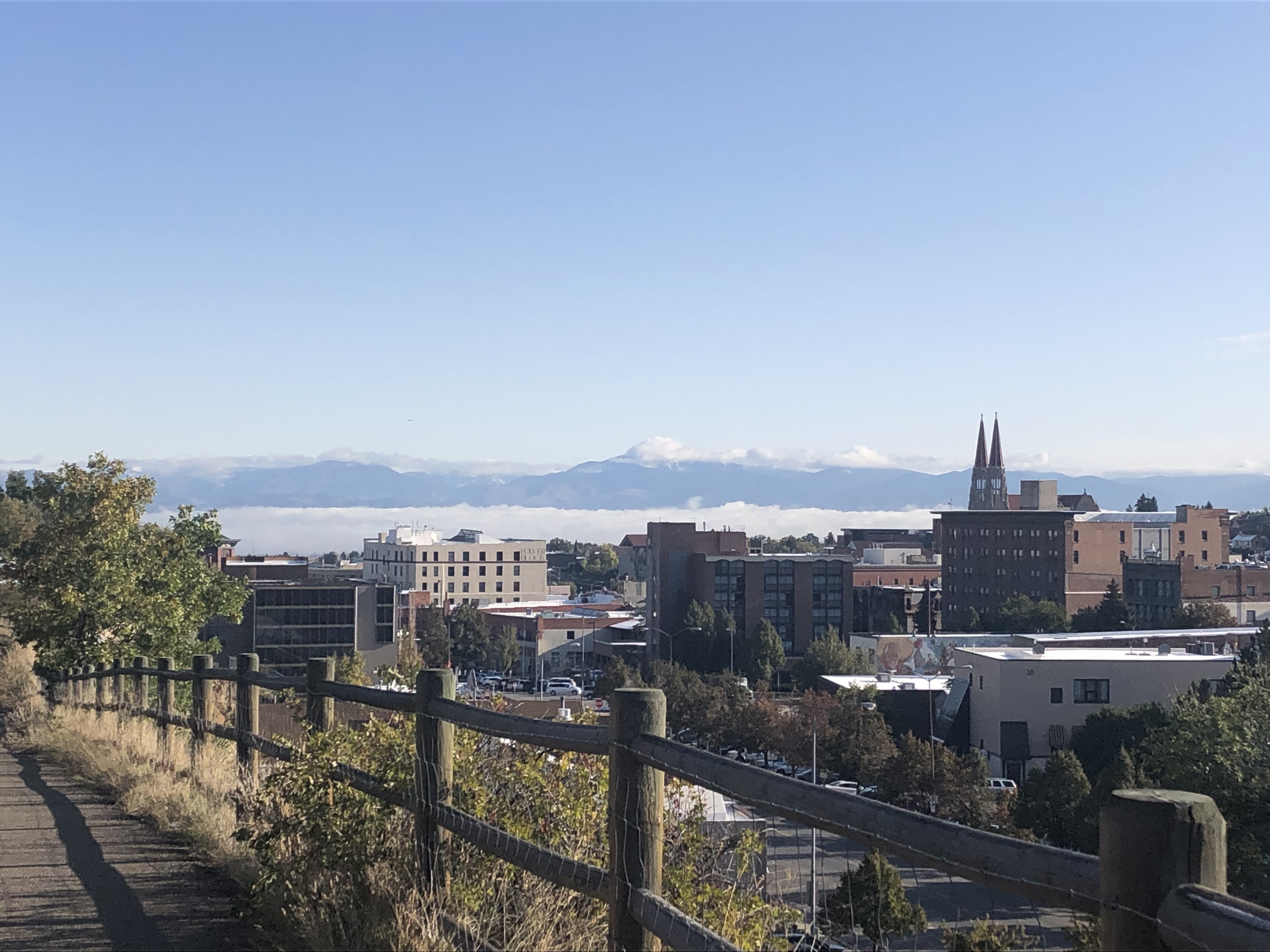
THE LUCK OF TOPOGRAPHY
We’re lucky that topography was so stubbornly assertive in old Helena. It’s fun. It’s good for
walking. Topography jostles with the man-made stuff in all sorts of place-making ways.
For one, there’s where bits of our old straight-line street grid dead-end abruptly against the
South Hills — each open-ended street or alley a walkable sightline, rooted well within the urban
fabric but running straight out to a de facto trailhead.
For another, there’s our narrow, crooked, gulch-bottom Main Street, all those dogleg bends of
10 to 15 degrees showing off the place — the immediate street-defining stuff and the slightly
farther district-defining stuff — at shifting oblique angles, a dance of sightlines.
Read more...
In that first case, sightlines confirm the immediate proximity of our open lands. We get two
kinds of landscape at once, in-town and out, with a standing invitation to walk between them.
In the second case, we get a zigzag half-mile of downtown vitality, another invitation to walk.
So, for walkable sightlines, it’s as good to have crooked streets doglegging through downtown
as to have straight streets dead-ending unceremoniously at the edge of town. We’d have
neither without the luck of topography. We wouldn’t have Reeder’s Alley either.
Louis Reeder struck a rare deal with topography. Knowing that it doesn’t take much
cut-and-fill to suit natural pedestrian agility, and in exchange for building stone, he let his
gully keep its identity. Though now urban, it’s still rocky and raw and steep-sided, still
legible as a natural young landform in very old rock.
Can Reeder’s Alley and those doglegs and dead-ends — quirks of old Helena — show us how to
treat the modern problem of urban connectivity? Think about it. I will, for my next notes.

THE FUN BIT
What’s best about those quirky old Helena streets mentioned in my earlier notes — those doglegs,
dead-ends and Reeder’s Alley — is that walking is still fun there. Things still connect there, in
walkable ways. The streets work better as walkable sightlines than as conduits for cars.
Cars are bulky. Moving or just sitting, they take up enormous amounts of space. We make space
by pushing things apart. The effect on urban form is fragmentation and dispersal. As things are
pushed beyond what’s assumed to be useful walking range, walking connectivity ceases to be
treated as a design element, regardless of actual distance. It’s all cars. We get Cruse Avenue.
Read more...
To again make walking an option (habitat restoration) is to acknowledge how it differs from
driving. One big difference is that walking is intimate; just you and place; no intervening bulk
with its own demands. It’s engagement with what’s just ahead or just to the side, not the
momentum of something you’re riding in, that keeps you going.
That’s only natural. Walking is your natural way of moving around. Nature equips you — senses,
agility, curiosity, imagination, etc. — to engage with whatever you meet afoot. Free use of this
nature-given equipment, at your own pace on a path that rewards its use, is fun. It draws you on.
The greater the distance walked, the more important this fun bit. It makes a long walk feel like a
short one, and turns a connector into a linear destination. On Main Street it’s a half-mile from the
north end of the 400 Block to the Library, but that’s the most pedestrian-packed half-mile in town.
It’s a half-mile also from the 400 Block to Centennial Park and Carroll College. Another
pedestrian connector? — a question for my next notes.
Helena by Foot
First, we’re pretty sure that “sense of place” has much to do with how we experience our unique built surroundings within their unique natural context, and that the experience is most accessible on foot.
So, we suggest that one of your walks be entirely within town — maybe in one of our historic districts or someplace else where the architecture seems intent on getting your attention — and that another walk cross from within town to some point that feels “out of town” — maybe across the interface between old Helena and our public open-lands.
- In both cases think about the shape and “feel” of the spaces you’re walking through, and about how the spatial sequence unfolds as you go along. Think about what you’re walking toward, among, past, between, under, etc. Think about the topography underfoot and the lay of the land. Is there a sense of elevation, slope, enclosure, edge, etc? Are you entertained by the lay of the land? If so, how and why?
- Do you take delight by what’s built on it? If you like walking among Helena’s old buildings, for example, is it because of the history? Or is it the character of the architecture itself — style, scale, texture, materials, workmanship, etc? What holds neighborhoods together? How “pedestrian-friendly” is the infrastructure?
- Think about the landmarks and viewpoints and transition points by which you navigate. Are transitions clear and inviting? Do glimpses of open land in the near distance — Mount Helena, South Hills etc, — bring on a welcome sense of proximity to the Montana countryside? Can you walk to it?
Access Some Questions We Considered at Our September "Thinking About Place" Drive-In Below!
Questions About "Sense of Place"
- Do you think that a person’s appreciation of a “sense of place” must necessarily involve an understanding about that place? Or can the recognition of a sense of place happen with little to no knowledge about what is being looked at/experienced, etc.? For example: Gertrude Stein’s “there is no there there” has been used as a description for placeless spaces. Can place be recognized just by looking at it…in the sense that it’s either there or its not? Or is some sort of special knowledge required in order to recognize place?
- Insofar as our sense of place is connected to our environment, and insofar as our environment is constantly changing – can any one location really have an enduring sense of place? Or will this always be fluid? Can you think of an example of a place you have been to that seems to defy this….and, if so, how so? What sorts of things might contribute to an enduring sense of place?a space, spot (be that a coastline, or building, or a city, etc.)
- Can a space/location/building etc. have a sense if place while at the same time being unremarkable, less than breathtaking, and common? Can you think of an example of this here in Helena?
- Must a sense of place evoke a sense of contentment? Or can it evoke a sense of discontent? Is there a space/spot/building/other here in Helena that you can think of that has a sense of place to it….but evokes feelings of discontent?
- What “place” ingredients are involved in what makes Helena, Helena?
Access Notes & Resources from our October "Thinking About Place" Workshop Below!
Helena by Sight
Second, note the sights that strike you as being unique, in any way, to Helena — sights essential to your mental image of the place. These might be the “iconic” sights, or “evocative” ones. They might be lucky visual accidents, or oddball juxtapositions. They might be sights that are surprising, quirky, peculiar (in any sense of that word), amusing, beautiful or engaging in any other way. Use whatever adjectives come to mind.
- We’re betting that by walking around out there and thinking about Helena in this way, and then getting together to share those thoughts, we can begin approaching “sense of place” in terms realistic enough to enter into consideration of Helena’s future growth and preservation.
For more information, contact:
Dennis McCahon at [email protected]
Marisa Diaz-Waian at [email protected]
This project invites people to explore Helena afoot & consider questions about “place” – an oft overlooked but critical element to the understanding and appreciation of a city and its history. A space is abstract; a place is a space with meaning. From its historic storefronts and iconic architecture to its meandering natural walls and pathways, Helena is packed with “place.” But why? What is it about Helena that continues to call out — not as a dot on map but as a unique lived experience that beckons and makes one feel at home? — Dennis & Marisa
⬇︎ADDITIONAL RESOURCES ⬇︎
“The Power of Spaces” (TED Radio Hour)
~Architect Michael Murphy, musician David Byrne, artist Es Devlin, and architect Siamak Hariri explore the power of spaces with NPR’s Manoush Zomorodi.
“What Makes a Building Beautiful?” (A Why? Radio Podcast)
~Philosopher & jazz musician Jack Russell Weinstein explores beauty, design, and more with Sarah Williams Goldhagen~

Learn more about some of our other fun philosophy-based community events & socials, including our: